Leaving Memphis to Mile Marker 695 Back on The Lower Mississippi

As we untied our lines and said our goodbyes, we could really feel the Autumn air. It wasn’t long before we ran into the storm. It gusted winds to 25 mph on the river. It was so cold, I had to breakout the long Johns for us. Funny, as I looked on Facebook, I noticed some of our family members were dealing with the first snow of the season. We needed to get moving south again. I see how easy it can be to stop moving on a trip like this. You find a place you like and it’s hard to motivate one self to leave. The rain came in so heavy with the blowing winds we could hardly see any tows. We knew we needed to find an anchorage soon.  We motored 40 miles and anchored at Mile Marker 695 for the night between two groynes. It was a nice spot.

Leaving the Memphis Canal Mud Island Marina

IMGP3225 

Here was three bridges right next to each other. All over a hundred feet of clearance.

IMGP3228

This semi truck was unloading his box onto the barge.

IMGP3232

This poor casino ran aground. Wonder what happened?

IMGP3238

Winter coat, long Johns and blanket. I am in my favorite spot looking for anything unusual floating in the water. Of course when it’s not camouflaged by waves. It’s hard to see floating timber when the winds are blowing. The timber seems to hide in the brownish waves.   

IMGP3240

One of the tows passed us are we were anchoring.  This is the famous Mississippi owned by the Army Core Of Engineers.  When it was built, it was the biggest tow.

IMGP3242

Here is a mural of the Mississippi that we saw at Hickman.

IMGP2493

See or position at http://trackmytour.com/35L17

IMG_0893

Thanks for following us! Red rose


Preparing to Leave Memphis

OM.Gosh.. after we returned our car rental We decided we should explore Main street by way of a  pedestrian bridge. This is a huge bridge. It crosses over the canal between Mud Island and Memphis. Main street was very quaint. You really can see the history in the buildings. The street was lined with cobble stones with a trolley track nestled between the stones. This town is so neat. Even if you don’t do the Mississippi come by car.   For those traveling the Mississippi, Memphis is a must stop.  And the Mud Island Marina is the place to stop as it provides walking access to so much.

This picture was taken from the walk way.  Beauty is tucked in front of the office.  This is a very cool marina.

IMGP3189

This is the pedestrian bridge that links the Marina to Main street Memphis. Under the walk way is a mono-rail trolley to transport people back and forth if you prefer not to walk.  They had just repaired it today.

IMGP3190

The walk from the bridge to main street takes you through this park.

IMGP3195

Water fountain in the park. It was a beautiful day.

IMGP3196

If I only had the body for this…

IMGP3200

I haven’t seen a pay phone in years. It is .50 cents to make a call. I remember .10 cents

IMGP3204

You can see the rails for the trolley.  Apparently the Trolley is shut down to repair the road.  No cars are allowed on Main Street.

IMGP3206

We walked in this colorful place to get an ice cream cone.

IMGP3207

We noticed the unusual mural art work on the side of a building.

IMGP3211

Restaurants galore.. They have all types of food anything you are hungry for.  Main street must be a mile long.

IMGP3214

I like these horse and carriages.

IMGP3216

We were walking back to the marina loved this view. 

IMGP3217

Hello my name is Inger.. I am the bookkeeper and I also do this and that. Inger is a real sweetheart.  Thanks for all your help doll. 

IMG_2570

Andy is the Harbor Master. I can’t say enough good things about him. Andy you and your team have become like family to us over the last 6 days. We will miss you all.

IMG_2569

Thanks foe following us! Red rose

Memphis, TN Day 4

You might be wondering what type of exciting adventures we did on our anniversary. Well, let me tell you if doing 4 loads of laundry, and shopping at Kroger’s sounds like fun… actually we did do all that and it was fun.  Believe it or not, I did 4 loads of laundry in 1 hour! I have never gotten that much laundry done an in hour.    Bryce found this laundromat on google. The reviews were great so we headed there.  It was very clean and it had air conditioning.

We have to return our car rental this afternoon. That means we will set our sites back on the river tomorrow. We spent 6 days here. Although it was a great time, we must start saying our goodbyes.


We received our gold Flag from America’s Great Loop Cruisers’ Association. This flag indicates that we finished the Great Loop. We are working on our second flag.  

 IMG_0882

Bryce writes reviews on all our anchorages or marinas that we stay at for Active Captain and they sent him this cap. Pretty cool.

IMG_0883

We went back believe it or not to the Brass Pro Shop for dinner at the top of the pyramid.

IMGP3179

Behind the bar was this interesting aquarium.

IMGP3176

After eating, we relaxed watching the sun set.

IMGP3181

Thanks for following usRed rose

Memphis- Mud Island Park, Beale St., Overton Square and Bass Pro Shops

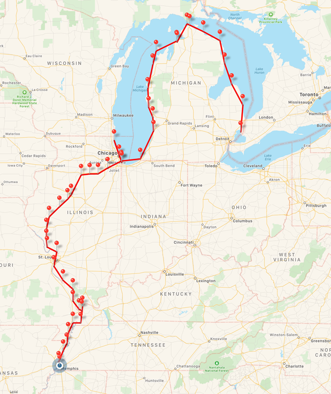
Memphis Riverwalk at Mud Island Park is an exact scale replica of the lower Mississippi River.  The model starts from the Kentucky dam above Paducah on the Ohio river side and a bit above the Ohio on the upper Mississippi side. They map out twenty cities along lower Mississippi in the Riverwalk model. It’s amazing the way the laid the concrete slabs to locate the river flowing through the Mississippi. There are four watershed walls which map out the entire drainage area for the Mississippi River. The structure shows the engineering designs of the floodways. It’s really neat. 

At the end of the Riverwalk model,  it empties into a one acre size Gulf of Mexico pool. At one time the locals say they could swim in it but they are no longer allowed to.  There are 1,746, 4 x 8 concrete sections, that were installed and positioned to allow actual water to flow from the north to the south.  The scale is 30 inches of model equals one mile of actual river.  The entire model length is about 2,000 feet long or just a bit less than 1/2 mile.

IMGP2966

The start of the Lower Mississippi from the Kentucky Lake.  This is the first major water shed as depicted by this wall.

IMGP2974

Here is Kentucky lake looking directly at the Kentucky dam from the North.  The dam dumps into the Tennessee, that flows down to Paducah.  For those that have gone through the lock, the lock is just to the left of this dam.  Notice the actual water flowing and the relief of the land cast into the concrete.

IMGP2976

Below Kentucky dam this picture shows the meeting of the Tennessee River (top) and the Ohio River (left) at Paducah.  The city of Paducah is represented by a scale model of the city and roads.  You can clearly see Owens Island.

IMGP2977

As the Ohio travels from Paducah, it passes Metropolis.  This picture gives an idea of the scale of this huge model.   Those of you that have made this part of the loop recognize these pictures are the area of Lock 52 and Lock 53.

IMGP2978

Traveling further on the Ohio, here I am standing on Cairo.  This part of the model shows the meeting of the upper Mississippi River and the Ohio River.  Notice the two actual bridges that cross the rivers.  The lower bridge connects the states Illinois and Missouri.  The bridge on the right, connects the states Illinois and Kentucky.  We passed under both bridges on our trip down the rivers.  We actually anchored between the lower bridge and the point of the island on the left. 

IMGP2979

Here is a picture of the Lower Mississippi as it meanders south on its relentless trip to the Gulf of Mexico.

IMGP2990

This is the town of New Madrid.  We anchored on the inside bend across from New Madrid.

IMGP2991

In Caruthersville, we anchored in the lower left corner in Caruthersville Harbor.  Very nice peaceful anchorage.

IMGP2994

Visitors are encouraged to walk on and wade in the river..

IMGP2996

And of course Memphis TN.  Notice again the actual scale bridges that cross the Mississippi.

IMGP3007

This picture also shows how the river twists like a snake.  The size of this model is quite mind boggling.

IMGP3027

Here we see the river coming up to Lake Pontchartrain on the upper left.

IMGP3080

And as it flows on, New Orleans is just behind me.  I can feel the cool wind as I near the Gulf.. Brrrr..

IMGP3084

And finally, you can see the river finally dumping into the Gulf of Mexico.  It is a huge pool that accurately depicts the Mississippi Delta.

IMGP3089

As we pulled away from the Riverwalk you could see Beauty with her orange kayaks from the road.  She is securely nestled in at Mud Island Marina.

IMGP3098


Beale St.

Brad Silver and Andy highly recommended a trip to Beale Street is downtown Memphis TN. It runs from the Mississippi River to East Street approximately 1.8 miles. Beale Street is rich in history along with history of the blues. They say the night life packs the streets with great music and food.  In 1860, many black traveling musicians began performing on Beale Street.

It was recommended by the harbor master Andy to have lunch here. It was delicious.

IMGP3104

We took a walked down Beale St. There are these huge guitars along the sidewalk.

IMGP3102

We found Elvis note and so many others.

IMGP3112

You know they have rum.

IMGP3114


Overton Square

Brad again recommended Overton square.  It is a fun place to hang out. They have several restaurants and shops. 

IMGP3117

I like the painting on Stanley’s.

IMGP3118

Bryce thought this was a great place for a photo opp.

IMGP3119


Bass Pro Shop

We do not often go to Bass Pro Shop.  But this one you must stop at.  This was a Basketball Stadium in Memphis.

IMGP3161

Inside is a huge Bass Pro Shop.

IMGP3129

In the middle, is a 300 foot free standing elevator.  With glass elevators.  Kinda freaky going up if you get giddy from heights.

IMGP3142

At the top of the elevator is a restaurant.  It has a number of these mechanical beasts hanging above the bar.

IMGP3153

Also at the top are two outside observation platforms.  Here is a picture of Memphis from one.

IMGP3147

From the other platform, looking towards the Mississippi, we see the river in the upper right where we came down.  The bridge connects Memphis to Mud Island.  Mud island has a bunch of condos and apartments and one of our favorite restaurants called Tug.

IMGP3151 

We ate at Tug’s twice..  Thanks for the recommendation Andy.

IMGP2963

Back to Overton Square

We went back to Overton Square Lafayette for dinner.  It seems they keep their help for a quite long time!!

IMGP3165

I had a great time here.

IMGP3163

We ended the night meeting up with Steve Miller a Friend of ours on Facebook who was also in Memphis while we where. It was great meeting you Steve. 

IMGP3169

Thanks for following usRed rose

Memphis TN, Graceland

Whether or not you are an Elvis Presley’s fan Graceland Mansion is an interesting visit.  It seemed so odd to me.  As we entered the tour bus we were handed a headset along with a tablet.  This was our tour guide though Graceland. The tablet showed a 3d image of every room and included some audio. I must say, I prefer a human tour guide. It was a great day at Graceland but a bit pricey.    

Me entering the gates to get our tickets.

IMGP2823

This is the Graceland Mansion from the outside front.

IMGP2826

As you enter the house, you see a formal living room.

IMGP2829

A downstairs bedroom for Elvis’s parents.

IMGP2834

A formal ding room opposite the front living room

IMGP2838

The kitchen would be considered modest by today’s standards.

IMGP2839

A basement TV room with original old TVs.

IMGP2843

A basement pool room.  Perhaps the cloth on the walls and ceiling deadened the sound of the pool balls.

IMGP2849

A lounge area was in the back of the house.

IMGP2853

Elvis’s daughter Lisa’s swing set..

IMGP2857

The back yard and back of house.

IMGP2861

This is the Elvis family tree.  Left side is Elvis father’s side.  Right is Elvis Mother’s side.

IMGP2864

This hand painted picture shows the gates and home as it probably appeared in the late 50’s/early 60’s judging by the car.

IMGP2877

This was the family pool.

IMGP2886

This was a game/lounge room in the Racquetball building.

IMGP2889

And the garden area where the gravesites are located.

IMGP2893

These are the 4 grave sites of Elvis, His Dad (Vernon), His Mom (Gladys) and Vernon’s Mom.

IMGP2897

After touring the house, we went across the street to the Exposition buildings that held numerous artifacts.  I thought this MG was a cool little car.

IMGP2904

IMGP2907

And of course his famous pink Cadillac.

IMGP2905

There were quite a few other cars in the collection including a Ferrari, Rolls Royce and Mercedes.

IMGP2921

I liked the pink Jeep..

IMGP2920

Various gold/platinum records..

IMGP2912

A boat Elvis owned..

IMGP2915

Various motorcycles Elvis owned.

IMGP2916

Elvis owned a few snowmobiles, but since there was very little snow in Memphis, he had wheels instead of skis..

IMGP2917

The Military  I Hope you can read the plaques? They say it all and is less typing for me..LOL

IMGP2926

Induction Day

IMGP2927

A son’s love for his mother.

IMGP2932

The year Bryce was born Elvis’s recorded his first Single

IMGP2936

I think I have seen all of his movies

IMGP2941

His Flashy clothing

IMGP2944

This is just a small portion of the record rewards Elvis received.

IMGP2946

This is a glimpse of part of the exposition area.

IMGP2954

Two of Elvis’s planes were here. This one is named the Lisa Marie after his daughter.

IMGP2959

And a smaller jet.

IMGP2960

As always Thanks for following usRed rose

Mississippi River Mud Island Marina Memphis TN

Memphis TN

Our first day in Memphis at Mud Island Marina was cleaning the boat outside and inside. What a beautiful day it was. Coming down the river a few days ago we were passed by  “The Office” It is a 40 foot Carver owned by Bob & Kathy.  Bod had talked to Bryce on the VHF and they said they were coming here.  When we arrived at the dock, they were here to greet us. The staff here at Mud Marina are so very nice. We had to fuel up and pump-out and fill up our extra fuel and water tanks so we will be prepared for our next section of the river.  A few locals stopped by, I wish I could remember their names.  They came by to see our boat. They are in the market to get one.

In the later afternoon we were invited to a cookout here at the marina with the staff and their spouses and friends. We had such a nice time. After dinner Bob and Kathy invited us on board for a few cocktails. What a pretty boat they have.

As we passed under the bridge in Memphis I noticed a Tennessee welcomes you on the expressway. I guess they don’t welcome us by boat..LOL There wasn’t a sign hanging below the bridge.  

IMGP2782

This was another 100 plus foot bridge clearance.

IMGP2777

Here is Memphis; our view from the river.

IMGP2788

We noticed Nina and Pinta reproduction boats moored in Memphis. 

IMGP2790

And a couple of river boats were docked here.  This one is the Island Queen.

IMGP2798

This poor little tow looks like it might have been used in a Bar-B-Q.

IMGP2800

The Memphis queen  again.

IMGP2801

As we continued down the harbor, there is a huge launch ramp and you can just see the marina on the left. These bridges are so tall there is nothing to worry about with a sailboat mast.

IMGP2808

in 2011 the water depth reached to the top Orange marker  Must be 50 feet higher than current depth. Then in 2012 they had record low 10 feet lower than now and the boats were sitting in the mud.  These guys go from feast to famine eh??

IMGP2809

Cook out time with new friends

Brad was a wealth of local information.  Alex Ertz, your friend wants to to stop in the next time you are doing the loop (do the lower Mississippi).

IMGP2811


This is Jim, he likes to cook.  He is an Attorney..

IMGP2812


Cereice & Chris and in the back ground; Glen and Bryce.

IMGP2815


Glen is a mechanic here working on boats. 

IMGP2814


Bob and Kathy what great host they are.  Thanks for the MartiniMartini glass

IMGP2818

www.trackmytour.com35L17 We are slowly making our way down, enjoying the river.  We are going to spend a few days here.

IMG_0876

As always thank you for following us. Red rose


Mississippi River Mile Marker 783 to Mile Marker 745 10 Miles from Memphis TN

I am very excited for today. We will be headed into Memphis, TN . It’s time for laundry to be done and some good cleaning. We are thinking of renting a car and doing some exploring. Alton (18 days ago) was our last time in a marina so looking forward to stopping for a few days. Someone posted on Face book to beware of the gators. I looked it up on the mighty web only to find out that a large 727 pound gator and 13 feet was caught on the Mississippi River.  It did not say where.  Memphis does have gators, coyotes,bobcats.. Oh my..

It’s a good thing George doesn’t get off the boat.

IMGP2706

We passed some interesting cliffs along the river.

IMGP2710

Apparently helped along by rain erosion.  I don’t think the river gets that high.  But perhaps the lower part of the cliffs was undermined by flood waters in the spring.

IMGP2711

We saw the Army Corp Of Engineers unloading a number of these large concrete slabs.  Perhaps to reinforce some dike somewhere.

IMGP2722

Here are a number of barges waiting to get unloaded… Look at all those concrete slabs.  

IMGP2724

This is officially largest number of barges we have seen connected to a tow.  It is 6 barges wide, 7 long and three more barges beside the tow.  Total of 45 barges.  This is longer than an aircraft carrier and nearly as wide.

IMGP2728

This is a large tow pushing that many barges.  It has three huge engines.

IMGP2734

I never though we would see 6 footers on the Mississippi but let me tell you the waves behind this vessels were huge.  The waves created by the tows are unusual.  They create relatively small diagonal waves compared to a power boat.  But their stern waves that travel directly back can be huge.  We hit the 6 footers created by this tow and it rocked us a bit.

IMGP2735

We passed this other tow.  The captain was so friendly on the radio when we called.  And as we passed, waved exuberantly. The captain is the man in the orange who stepped out on deck to say hello to us… such nice people.

IMGP2741

This looked so inviting but the current was to strong to make for a pleasant anchorage.

IMGP2746

Someone planted the flag on this beach… God Bless America!

IMGP2745

Here is our trip so far at www.trackmytour.com/35L17

IMG_0874

This our anchorage last night. We are 10 miles up stream from Memphis.  It was a relatively calm anchorage off the channel

IMG_0873

Thank you for following us!Red rose

Mississippi River Mile Marker 809 to Osceola Mile Marker 783

What a restless day! I woke up a bit crabby and my mood stayed with me for part of the day. I think that is why we might have anchored a bit early.  After dropping off for the night, I slept soundly for about three hours, then it’s time to do something. LOL.. I whispered “Honey are you awake”  He squirms for a moment..”I am now!  What’s wrong?”  Nothing I just can’t sleep. He pulls the covers back over his head! So that is when I come out into the salon and gab to you all. It works well for me because I get out all the energy of talking through writing my blog.  Sometimes I talk a lot don’t I..LOL 

Hey, do you know how many barges are pushed by a tow?

The average tow has 15 barges, but flotillas can go up to 40 barges, depending on the type of cargo, the river segments being navigated, and the size of the towboat. We have seen the largest at 6 wide by 7 long or 42 barges.  The longest we saw was 8 barges long.  Smaller tributaries, such as the Alabama River, can support only a four-barge tow because of the meandering nature of the river and varying width of the river itself. In addition, the Alabama’s locks are only 84 feet wide and 600 feet long.  These are just some fun facts I read about and wanted to share with you.

This little guy came and tooted his horn. Bryce heard him on the VHF hale us “sailing vessel.” A southern voice came across “Just checking to see if  you all are okay.”  They must have been watching us… LOL.. we were inside most of the morning.  We thanked him for checking on us as he putted away.

IMGP2679

OM Gosh…..more whirlpools. I always joke about getting sucked down into a new dimension… On the Mississippi; they have groynes under the water.  At narrow portions of the river or where the river runs along the shoreline we will often see whirlpools.  According to the web, the revolving current in the river maybe caused by the irregularities in the bottom of the river along with the meeting of the currents. Most whirlpools are not very powerful, but you do need to beware of them. We can feel the power of the small ones when we have to correct our steering.   I read this morning that in the Spring floods when the rivers are high, even the tows and barges have issues with large whirlpools.  Three barges apparently sank in 2011 due to the rushing waters and whirlpools during the quite violent spring floods.

IMGP2683

This was one big log floating down stream.  It measured about 2 feet diameter and 15 feet long.

IMGP2687

You can see three tows here but the river is so wide it’s not any big deal.  We one time passed between two tows on either side of the river.

IMGP2692

This is an interesting looking area. I was trying to figure out what the huge clumps were. Maybe it’s just there from the spring floods.

IMGP2688

We saw this house on the bank of the river. It’s the first home we have seen in a while.  They picked a nice area on the river to build.  I hope the spring flood doesn’t reach their home.

IMGP2690

This boat ramp is just down from the house above.. .

IMGP2691

Talk about color coordinating…Maybe the Captain is a woman..LOL Okay, I know men can coordinate color too..

IMGP2697

Our tracks so far this trip. We have only been on this journey for 1 month and 3 weeks.  We will be in Memphis in a few days.

Last night we anchored at Mile Marker 783 at Keyes Point near Osceola. Our Latitude is 35.6558 Longitude –89.9129 The water depth is 13 feet and we have a 2 mph current with the water temp of 68 degrees. This wasn’t such a good place to anchor. Normally smooth, but as the larger tows passed we had some rocking.  Sometimes the gentle rolling helps me sleep; but of course with out the lullaby.. LOL Small tows along the shore were shuttling barges to/from the loading/unloading depots all during the night.  Sometimes they revved their engines in their battle with the 5 mph current.   We did not expect it would be so busy all night long!!

You can check out our tracks at www.trackmytour.com/35L17 

IMG_0859

Joke Time

I bought some shoes from a drug dealer. I don’t know what he laced them with… But I have been tripping all day..Smile LOL


As always thanks for following usRed rose

Mississippi River Caruthersville Mile Marker 849 to Nebraska Point Mile Marker 809

As the sun is shinning from her highest point of the day, the computers shut down.  We pulled up our anchor to head back down the river. Nearly 4 miles from our anchorage in Caruthersville was our first highway bridge Interstate 155. She stood tall probably 80 feet as we passed under her shadow. Beauty would have no issues with this clearance with her mast up.  It was a gorgeous day with sunny sky and moderate 75 degrees.  The winds blew lightly today from the South creating some ripples on the river camouflaging the floating timber passing there way down the river.  Every once in a while we see floating objects in the lower river.  These floaters are due to the recent heavy rain.  We are enjoying the fact that we have no more locks to go through!!!  Only lock is through New Orleans to get to the GICW.

We found anchorage off Nebraska Point Mile Marker 809. The current is 1.7 mph along with the depth of 15.3 feet. The fall air is cooling down the water temps 68 degrees and falling. According to Wind-Alert the winds were low for the night. But let me tell you it was wrong! The winds blew 20 mph during the night.  We slowly rocked in the small waves. Actually the rocking wasn’t bad. I just needed a lullaby…Note 

What a amazing view! We anchored just off Nebraska Point. George liked it too.Cat face

IMG_0852

As we were motoring out of Caruthersville harbor when we noticed this barge getting loaded. The front was completely out of the water;  it was doing wheelie…

IMGP2621

This is the boat ramp you can use to go into Caruthersville. But It’s quite a distance from the harbor to get there.

IMGP2625

First sighting of Interstate 155 bridge. This is the first bridge since Cairo. This bridge is 7,102 feet long and is 78 feet wide. The longest span is 920 feet (280 m) and 520 feet (158 m).  This is the only bridge over the Mississippi between Cairo Ill and Memphis TN.  That is 85 miles the way the bird flies to Cairo and 55 miles to Memphis TN.  A bit of a distance between bridges.

IMGP2626

Apparently, this is a Cantilever bridge. They started building it in 1969 and finished it in 1976.  The Ferry we saw in Hickman does cross over the Mississippi River. Interstate 155 connects the two States Missouri and Tennessee. She first opened in December of 1976.

IMGP2647

The Clearance of this bridge according to the chart sources is 99 feet.  The actual clearance is 99 feet minus the local river gauge depth.  As we see here, the actual height is about 80 feet.  I like having the vertical clearance on the bridge.  We could easily pass under this bridge with our mast up.

IMGP2643

This is another tow pushing a big load…

Have you ever wondered why is a towboat called a towboat when it pushes the barges?

The word “tow” comes from the canal age when a draft animal walking along the bank of the canal pulled a barge. As river men gained experience with moving barges, they found that, by lashing barges together and pushing them, they could control the barges better and move more of them. The control was especially helpful when navigating the smaller rivers and tight bends in a river. On the Eastern sea board is the Erie Canal.  You can still see the banks called a toe path where Sal pulled the barges along the canal. This is where the song comes from: Fifteen Years on the Erie Canal and a mule named Sal.

IMGP2622

Several tows passed us by once again.  This is a monster tow.  Notice that it is 5 stories tall and with antennas on the top, this barge is as high as our 60 foot mast. I often wonder what life would be like to travel on the river. My mind wonders back to the early 1800-1900s as the paddle wheelers traveled these parts. How much fun that would be.  Okay, so I have to add a Mississippi cruise on the American Queen to my bucket list.

IMGP2652

This is so cute to me.. it looks like this little tow could barely see over the barge.  The barges float up this high when they are empty.

IMGP2654

I thought this was an interesting setup.  The trucks bring the farmer’s harvest directly to a grate on the road where they dump the grain down onto conveyers that immediately place the grain into the barge.  There is no intervening silo or storage facility.  Amazing to see how many barges go up and down the Mississippi.

IMGP2661

Just a bit upstream from the loader is a staging area for full barges waiting for a tow to push them (presumably) down the river.  Other empty barges waiting to get filled.

IMGP2659

This little tow was shuffling barges around.

IMGP2663

A short distance down stream was this excavator unloading what looked like perhaps fertilizer or seed, not sure.  So I suppose farmers could get seed and fertilizer and drop off the resulting grain.

IMGP2668

Every once in a while, we see through the camouflage a floating log. It’s kind of like an Easter egg hunt… instead of eggs, it’s logs…

IMGP2666

Bryce and George are best buds…  Bryce you need a shave..  Without his electric shaver, he is only shaving every other day.

IMG_0849

Sunset over the Nebraska Point MM-809

IMGP2675

The following are bridges we passed under. I will post them as we go under them.

                    Bridges                    Actual clearance

  • Interstate 155                    80 feet

As always we appreciate you following us. Red rose

Mississippi New Madrid Mile Marker 890 to Caruthersville Mile Marker 849

It was another tranquil day floating down the lower Mississippi.  I get such a kick out of seeing the tows go by. They all wave,  It’s as if they were telling us to have a great trip. I wave back and in my mind, I am telling them to have a great day at work.  The winds were light today.  Not a ripple on the water.  I had to slide a thin jacket over my shoulders due to the cooler temps.  It’s kind of strange to know that on one side of the river is Missouri and on the other Kentucky. Missouri seems like it has a bit more industry whereas Kentucky seems like it might have a bit more sandy beaches. I don’t know why I said (strange) because at home we live on Lake St. Clair one side is the U.S and the other is Canada. We are going to anchor in Caruthersville Harbor tonight.  We checked Caruthersville on Active Captain. It seems like a nice place.

The following are towns you can use google maps to see what they have to offer. You are able to dinghy to boat ramps in these areas.  When starting the trip to the lower Mississippi you can take fuel cans into Mound City on the Ohio to get diesel. 

  • Mound City for Diesel-Mile Marker- 971 Ohio River 15 miles from Mississippi mile marker 0
  • Hickman KY- Mile Marker 921, Mississippi River
  • New Madrid MO- Mile Marker 890
  • Caruthersville MO- Mile Marker 849

Another barge getting loaded with grain. This is on the Missouri side of the river

IMGP2566

We are getting a lot of questions about our boat size, mast and draft:  We have a Catalina 400.  It is a 41 foot boat, mast is 60 feet tall, draft 5.7.  Our displacement is about 25,000 actual, 20,000 by design.  On the lower Mississippi we haven’t seen any bridges yet. LOL I know we will soon. I will blog all the bridges and heights.  We have done the Tenn-Tom on our last trip down.  The actual bridge heights in fall are usually much higher than listed bridge heights due to lower water in the fall.  You will need to remove your mast near Chicago for the Illinois River which is 19 feet.  I believe we could restep at the Mississippi/Ohio River junction, but there is no marina to do it.  It is doubtful anyone will sail on any of these rivers as they twist like a snake.  Water depth in the lower Mississippi River channel so far has averaged about 45 feet.  Minimum is about 20 feet, maximum is about 90 feet.  Large tows require 10 feet, so no concern about water levels as long as tows are running.

We are also using a tracking map at TrackMyTour.com/35L17 Feel free to ask more questions

You really get a choice on boat ramps . There sure are a number of them.

IMGP2568

I am totally amazed at all the anchorages along the shoreline.  Ideally on inside river bends where the current is lowest.  Next time we do this trip I want to leave in the warmer months so we can stop in more places.

IMGP2571

This looks like a roadside stop. There is a pickup truck enjoying the scenery. 

IMGP2575

See all the white birds on shore? They are all Geese or swans (hard to tell with Binoculars) perhaps migrating.

IMGP2577

Well. I finally see another probably local launching his fishing boat.  I see a small dam in the background.

IMGP2581

This river is so wide you never have to wonder if there is a tow ahead.  You can see them a long way off. We have two headed north  in this picture.  But we do have AIS to tell us the tow’s position, speed and name.

IMGP2588

Looks like someone has been enjoying riding in the sand with ATVs.  We often see ATVs along the shore.  Kinda miss our ATVs sometimes.

IMGP2590

Bryce looking ahead to see what side he will be passing the tow on.  Binoculars are quite useful; particularly at night where their large objective lenses gather more light than our eyes.

IMGP2591

We spotted a Bald Eagle sitting on the point as we entered our anchorage in Caruthersville Harbor.

IMGP2603

Dusk was settling in as we made our way around the point in to Caruthersville Harbor.  I love the fact that Bryce just takes it slow coming into anchorage and uses his GPS as his guide. With me on the bow looking for objects in the water.

IMGP2609

As we drove passed we could see the dust from the grain floating in the air.

IMGP2611

Okay, this little blue dot is us safely anchored away for the night in Caruthersville Harbor. We didn’t have any issues with water depth or any issues coming around the southern point to enter the harbor. When you enter the harbor you’ll see barges.. no worries.  Move to the curve see the blue dot and anchor.  No current, no wakes at this anchorage.  Although a small working tow may shuffle the barges around during the night.

IMG_0842

Google maps shows Lady Luck Casino in Caruthersville, restaurants , a drug store and a few other places.  A boat ramp in Caruthersville is available for landing to go into town. 

IMG_0843

We appreciate you following usRed rose